Nature · Dolomites · provincial terrain section
Tre Cime di Lavaredo: terrain elevation and local relief
Tre Cime’s Cima Grande reaches a sampled 2,992.4 meters in the provincial 2.5-meter terrain grid.
≈ 2,992 m
Data-derived estimate- Measurement
- Highest sampled elevation · South Tyrol provincial geoid
- Subject or version
- Dolomites · provincial terrain section
- In feet, rounded
- 9,817.5 ft (1 ft = 0.3048 m)
Add more subjects or change the units in the playground.
Terrain boundary, base and datum
- Vertical reference
- South Tyrol provincial geoid. Published surveys are separate; no datum conversion is applied.
- Highest sampled surface
- 2992.4 m at 46.619398°, 12.302611°.
- Local base
- 2009.7 m at 46.629320°, 12.287798°. Lowest valid source sample within this bounded section.
- Section bounds in ETRS89
- West 12.286201°, east 12.318120°; south 46.617685°, north 46.629348°.
- View and scale
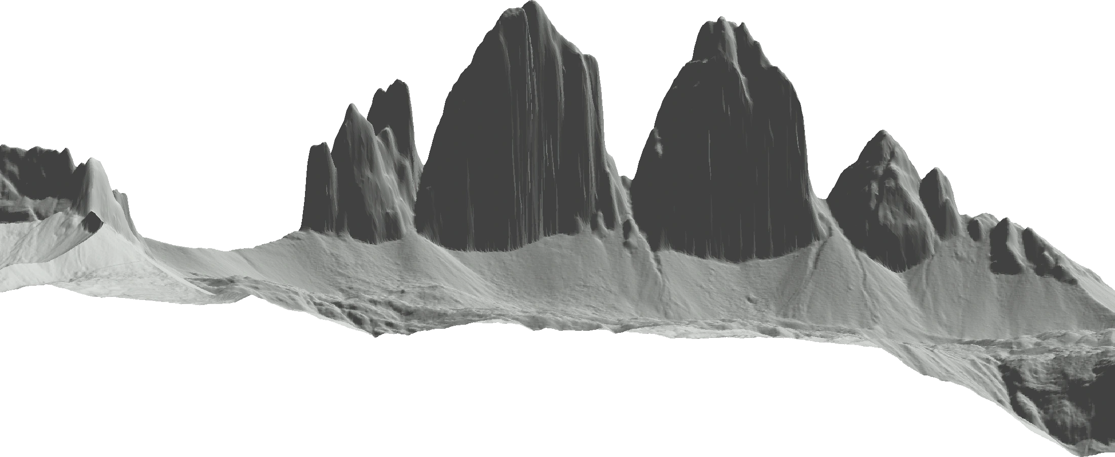
- Orthographic map section facing south. Equal horizontal and vertical map scales. Approximate grid spacing: 2.5 m east-west and 2.5 m north-south. Lower and surrounding terrain omitted.
Autonomous Province of Bolzano, DTM 2.5 m, CC0.
A little more perspective
The Autonomous Province of Bolzano’s 2.5-meter DTM, published in 2006 from the 2004–2005 survey, contains a maximum of 2,992.3601 meters near Cima Grande. The sample lies about 68 meters from the independent summit coordinate. Italy’s tourism portal gives 2,999 meters for the highest peak; that rounded reference is kept separate from the terrain samples. Elevations use the producer’s provincial geoid and ETRS89 horizontal coordinates.
This view looks south at the north walls of Tre Cime. Its approximately 2.4-kilometer-wide section includes only the available provincial terrain around the peaks. The lowest valid sample is 2,009.7 meters, giving 982.6 meters of relief within this window. Missing coverage south of the provincial boundary stays transparent. This base describes the selected section and does not define the prominence of Cima Grande.
Native 2.5-meter EPSG:25832 WCS grid values, with ETRS89 geographic coordinates reported. Orthometric heights use the provincial geoid described by the producer. The camera faces south toward the north walls. Only quads with four valid provincial-coverage samples are drawn; absent southern coverage stays transparent. No interpolation or summit correction.
Quick facts
Tre Cime’s Cima Grande reaches a sampled 2,992.4 meters in the provincial 2.5-meter terrain grid.
For a presentation or a research note, include the subject, the measurement definition, and the measurement used. A picture alone cannot explain those choices. The comparison guide explains how to export an image and its source notes together.
Sources and measurement notes
- Province of Bolzano: survey dates, native grid and provincial geoid
- Provincial open-data catalog: DTM 2.5 m and CC0 license
- Italy tourism: three peaks and independent highest-peak reference
- Independent starting summit coordinate
- Original published elevation service
Keep the named datum and bounded base with this terrain estimate.
Source review recorded . Suggest a correction with a source and the exact measurement being compared.