Nature · Wyoming · native one-meter USGS terrain
Devils Tower: terrain elevation and local relief
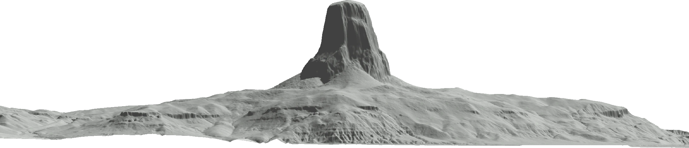
Devils Tower reaches a sampled 1,558.1 meters in NAVD88 in this one-meter USGS bare-earth elevation model.
≈ 1,558 m
Data-derived estimate- Measurement
- Highest sampled elevation · NAVD88
- Subject or version
- Wyoming · native one-meter USGS terrain
- In feet, rounded
- 5,111.8 ft (1 ft = 0.3048 m)
Add more subjects or change the units in the playground.
Terrain boundary, base and datum
- Vertical reference
- NAVD88. Published surveys are separate; no datum conversion is applied.
- Highest sampled surface
- 1558.1 m at 44.590511°, -104.715180°.
- Local base
- 1171.1 m at 44.590627°, -104.703954°. Lowest sampled point within this bounded terrain section.
- Section bounds in NAD83
- West -104.726650°, east -104.703924°; south 44.583956°, north 44.596607°.
- View and scale
- Orthographic map section facing north. Equal horizontal and vertical map scales. Approximate grid spacing: 1.0 m east-west and 1.0 m north-south. Lower and surrounding terrain omitted.
U.S. Geological Survey 3D Elevation Program, WY_FEMA_East_2019_D19. Public-domain bare-earth elevation data.
A little more perspective
The WY_FEMA_East_2019_D19 USGS 3DEP tile, published July 4, 2021, preserves the tower’s narrow rock column at native one-meter spacing. Its maximum is 1,558.0868 meters in NAVD88, about 27 meters from the initial summit coordinate. The displayed decimals retain a stored raster value and do not claim millimeter survey accuracy. The familiar USGS 5,112-foot reference comes from the 1984 quadrangle and remains an independent source.
This bounded section has 387.0 meters of local relief above its lowest sampled point, at 44.590627° latitude and -104.703954° longitude. That base belongs to the documented window; it is not a universal mountain base, topographic prominence or a climbing route’s ascent.
Native 1-meter UTM zone 13N NAD83 grid samples. Geographic coordinates are transformed to NAD83 longitude/latitude for reporting; elevations stay in NAVD88. No resampling, summit correction or datum conversion.
Quick facts
Devils Tower reaches a sampled 1,558.1 meters in NAVD88 in this one-meter USGS bare-earth elevation model.
For a presentation or a research note, include the subject, the measurement definition, and the measurement used. A picture alone cannot explain those choices. The comparison guide explains how to export an image and its source notes together.
Sources and measurement notes
- USGS 3DEP: tile metadata, NAVD88, NAD83 and public-domain status
- USGS: selected eastern summits, Devils Tower 1984 quadrangle 5,112 feet
- NPS: Devils Tower base, river and summit distinctions
- Original source elevation tile
Keep the named datum and bounded base with this terrain estimate.
Source review recorded . Suggest a correction with a source and the exact measurement being compared.