Nature · Rio de Janeiro · municipal lidar terrain
Sugarloaf Mountain: terrain elevation and local relief
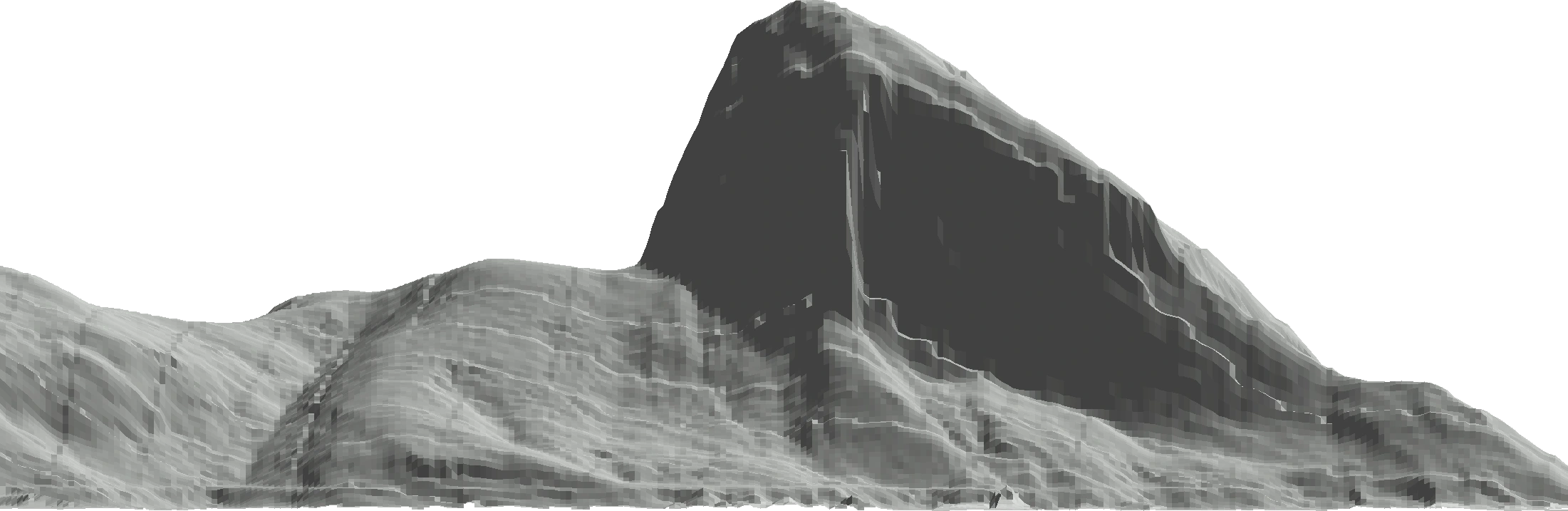
Sugarloaf reaches a sampled 392.0 meters in Rio’s published lidar-derived terrain cache.
≈ 392 m
Data-derived estimate- Measurement
- Highest sampled elevation · Imbituba
- Subject or version
- Rio de Janeiro · municipal lidar terrain
- In feet, rounded
- 1,286.1 ft (1 ft = 0.3048 m)
Add more subjects or change the units in the playground.
Terrain boundary, base and datum
- Vertical reference
- Imbituba. Published surveys are separate; no datum conversion is applied.
- Highest sampled surface
- 392.0 m at -22.949423°, -43.156528°.
- Local base
- 0.0 m at -22.948751°, -43.151250°. Lowest valid source sample within this bounded section.
- Section bounds in WGS84 Web Mercator
- West -43.162537°, east -43.150778°; south -22.953493°, north -22.945392°.
- View and scale
- Orthographic map section facing north. Equal horizontal and vertical map scales. Approximate grid spacing: 4.4 m east-west and 4.4 m north-south. Lower and surrounding terrain omitted.
Instituto Pereira Passos / Prefeitura da Cidade do Rio de Janeiro, 2019 lidar-derived DTM, CC BY 4.0. Rendered from the published elevation cache.
A little more perspective
The Instituto Pereira Passos municipal portal publishes a 5-meter DTM derived from Rio’s 2019 lidar survey. Its decoded elevation cache contains a highest sample of 391.9894 meters, about 14 meters from the independent Sugarloaf summit coordinate. The cable-car operator’s 396-meter reference remains separate. The original survey’s Imbituba vertical reference is supported by the producer’s cartographic documentation; the served cache reports positions through WGS84 Web Mercator.
This roughly 1.2-kilometer section looks north toward Sugarloaf and retains the shoreline terrain present in the source. The lowest valid cached node is zero meters, so the section’s sampled local relief is also about 392 meters. That zero is a published terrain value, not a new tide measurement. Missing coastal coverage stays transparent.
Unchanged decoded level-15 LERC cache nodes. Overlapping tile edges disagree by up to 0.512 meters; the first tile node is retained with no averaging. This exceeds the 0.05-meter LERC compression bound, which is not a total accuracy statement. The original municipal DTM was reduced to 5-meter resolution; cache spacing does not add source detail. Web Mercator spacings are converted to approximate ground meters at the section center. WGS84 geographic positions follow the served cache; the original survey uses SIRGAS 2000 and Imbituba. Only valid four-node quads are drawn; missing coastal data remains transparent. No ocean fill, datum conversion or summit correction.
Quick facts
Sugarloaf reaches a sampled 392.0 meters in Rio’s published lidar-derived terrain cache.
For a presentation or a research note, include the subject, the measurement definition, and the measurement used. A picture alone cannot explain those choices. The comparison guide explains how to export an image and its source notes together.
Sources and measurement notes
- IPP municipal catalog: 2019 lidar-derived DTM and CC BY 4.0
- IPP cartographers: survey products and Imbituba reference
- Cable-car operator: independent 396-meter reference
- Independent starting summit coordinate
- Original published elevation service
Keep the named datum and bounded base with this terrain estimate.
Source review recorded . Suggest a correction with a source and the exact measurement being compared.